Satellite & Earth Observation Data in African Farming: Benefits & Uses
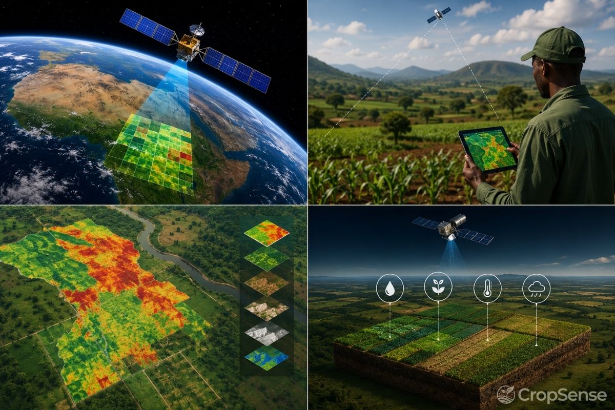
Across Sub-Saharan Africa, smallholder agriculture forms the backbone of economies, yet remains vulnerable to climate volatility, information gaps, and severe under-financing. Earth Observation (EO) data and satellite imagery are changing this dynamic, delivering hyper-local insights for farm management while providing financial institutions with the visibility needed to de-risk agricultural lending.
Introduction: The Satellite Revolution in African Agriculture
African agriculture stands at a pivotal threshold. Home to over 60% of the world's uncultivated arable land, the continent holds immense potential to not only achieve regional food security but to become a global agricultural powerhouse. However, smallholder farms, which produce up to 80% of Sub-Saharan Africa's food supply, face persistent systemic headwinds: climate change-induced droughts, soil degradation, unpredictable pest infestations, and a critical lack of access to capital.
Historically, monitoring smallholder fields across vast, fragmented landscapes was prohibitively expensive and logistically impractical. Manual ground surveys were slow, localized, and often inaccurate. Today, Earth Observation data combined with artificial intelligence is bridging this gap. By capturing high-frequency optical, radar, and thermal imagery from space, satellite technology is transforming raw environmental data into actionable field intelligence for farmers and financial stakeholders alike.
1. Precision Crop Health & Field Monitoring
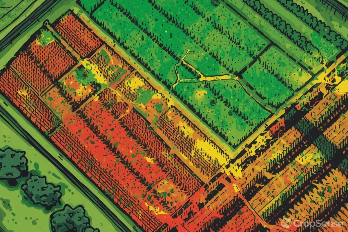
The primary baseline application of Earth Observation in farming is real-time crop health monitoring. Using multispectral satellite sensors, advanced platforms compute vegetation indices such as the Normalized Difference Vegetation Index (NDVI) and Enhanced Vegetation Index (EVI). These indices measure chlorophyll absorption and canopy structure, giving precise indicators of crop vigor.
- Early Stress & Anomaly Detection: Satellite imagery enables agronomists to identify crop stress, caused by moisture deficiency, nutrient imbalances, or early pest emergence, weeks before visual signs appear to the naked eye on the ground.
- Spatially Targeted Input Application: Instead of applying uniform fertilizer or pesticide treatments across entire fields, satellite insights enable variable-rate application. This dramatically cuts input costs for farmers while minimizing environmental runoff.
- Micro-Climate Tracking: Satellite-based land surface temperature (LST) and soil moisture monitoring provide granular, real-time weather analytics tailored to specific field coordinates rather than distant weather stations.
2. Advanced Yield Prediction & Optimization
For agribusinesses, off-takers, and government planning agencies, accurate yield forecasting is critical for supply chain planning, storage logistics, and national food security strategies. Traditionally, yield estimation relied on post-harvest sampling or subjective eye-estimates.
By blending historical Earth observation data with machine learning models, solutions like CropSense AI forecast crop yields with high accuracy months before harvest. Satellite analytics track growth trajectories across the crop lifecycle, comparing current biomass accumulation against multi-year regional baselines.
Key Impact: Supply Chain & Market Stability. Accurate harvest projections allow aggregators and processors to optimize logistics, reduce post-harvest losses, and secure fair forward contracts for smallholders, insulating rural communities from sudden market price crashes.
3. Unlocking Agricultural Finance: De-Risking Lenders & Insurers
Perhaps the most transformative impact of Earth observation data in Africa lies in its ability to unlock formal financial services for underserved farmers. Despite representing a substantial portion of GDP, agriculture receives less than 5% of commercial bank lending across Sub-Saharan Africa. The root cause? High perceived risk and the prohibitive cost of physically auditing dispersed, smallholder plots.
Satellite technology acts as a virtual auditor, creating transparency between rural borrowers and financial institutions:
A. Digital Farm Verification & Boundary Mapping
Before extending credit, lenders must verify that a farm exists and evaluate its historical productivity. Satellite imagery provides automated field boundary delineation and historical crop performance scores without sending an auditor to the field.
B. In-Season Portfolio Monitoring for Lenders
Once loans are disbursed, whether in cash or input vouchers, banks and microfinance institutions (MFIs) can monitor thousands of funded farms simultaneously via automated satellite dashboards. If drought strikes a specific district, lenders receive early indicators and can proactively adjust repayment schedules or deploy support.
C. Parametric Crop Insurance Validation
Traditional crop insurance requires manual loss assessment, an operational nightmare for small fields. Satellite-derived rainfall, soil moisture, and vegetative drought indices enable parametric insurance. Payouts are triggered automatically when satellite metrics fall below defined thresholds, ensuring rapid payouts to farmers during crop failure.
4. Environmental Sustainability & Climate Resilience
As carbon markets expand across Africa, Earth observation serves as the gold standard for Measurement, Reporting, and Verification (MRV). EO data tracks sustainable land-use practices, such as cover cropping, agroforestry, and reduced tillage.
Furthermore, satellite imagery helps trace supply chains to ensure compliance with global regulations such as the EU Deforestation Regulation (EUDR), protecting African commodity exporters in cocoa, coffee, and palm oil sectors from being excluded from international markets.
How CropSense AI Empowers the Agricultural Ecosystem
At CropSense AI, we turn raw satellite observations into operational decisions across the entire agricultural value chain:
- For Farmers & Agronomists: Simple, mobile-accessible crop health alerts and precision advisory to boost yields and lower input expenditures.
- For Banks & Agri-Lenders: Satellite-backed credit scoring, risk modeling, and continuous portfolio monitoring to safely expand agricultural loan books.
- For Enterprise Agribusinesses & Off-takers: Granular yield forecasts, harvest timing optimization, and supply chain tracking.
Conclusion
Earth observation data is no longer an academic tool reserved for scientific institutions; it is an active engine for economic development across African agriculture. By lowering the cost of field visibility, maximizing crop performance, and unlocking essential credit for smallholder farmers, satellite intelligence is paving the way toward a resilient, profitable, and food-secure future for Africa.
Ready to Transform Your Agricultural Portfolio?
Discover how CropSense AI leverages satellite analytics to optimize yields and de-risk agricultural finance. Request a platform demo today.